
TAB 1 CONTENT : How to create new tab item
If you need to create a new tab, first open the « Document Overview ».
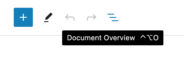
Add item to navigation menu
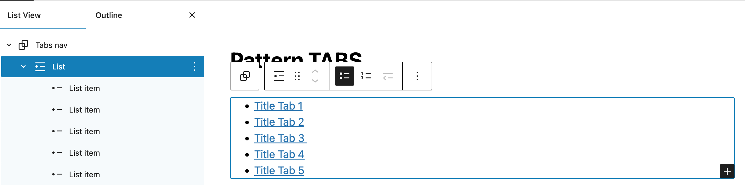
You need to add a new item in the list (group Tabs Nav > List).
In the « Document Overview », select to block « List », and click on the black « + » button inside the editor block.
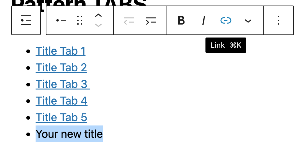
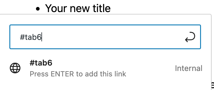
Make a link on your new title text to #tab{number}.
Last step, is to give an additional CSS class to your new item.
Select it from the « Document Overview », and go to the options block in the right sidebar.

Add the additional class « tab ».

Add tab content group
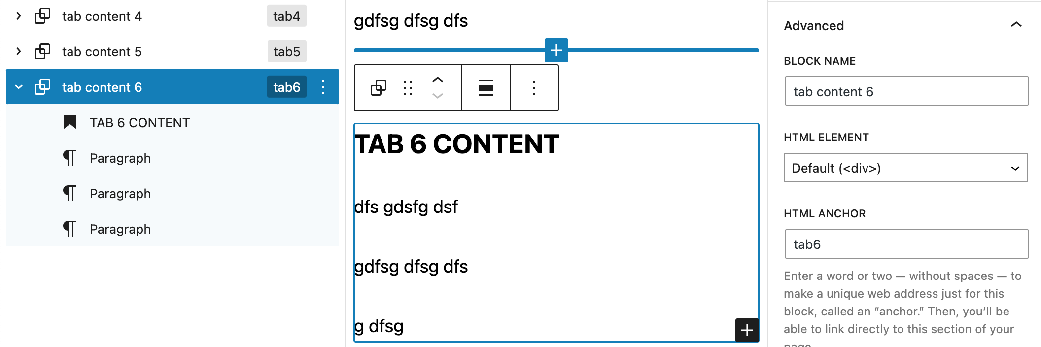
Now create the new tab content {number} group. The simplest way is to duplicate one of the existing « tab content » from the « Document Overview ». (option in the 3 vertical dots)

Select your new block group, go to the right column in block options, and deploy « Advanced » options.
Give a new explicit name to your group (block name), and fill the html anchor name with tab{number} choosen in the list item link.
That’s all !
TAB 3 CONTENT
dfs gdsfg dsf
gdfsg dfsg dfs
Recrutement : Post-doctorant (H/F) PC4-WP2
Rejoignez l’équipe FormaTerre ! FormaTerre recherche, en collaboration avec le BRGM, un·e post-doctorant·e en CDD de 18 mois pour développer un agent conversationnel dédié à la géologie, au sein du […]
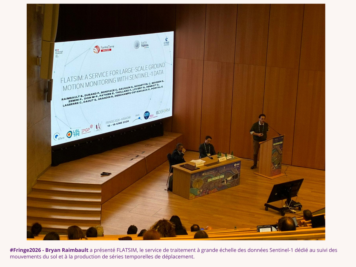
Retour sur notre participation au workshop #Fringe2026
Du 15 au 19 juin 2026, Cracovie (Pologne) a accueilli le Fringe 2026, le 13ᵉ atelier international dédié aux avancées scientifiques et applicatives de l’interférométrie SAR (radar à synthèse d’ouverture). […]
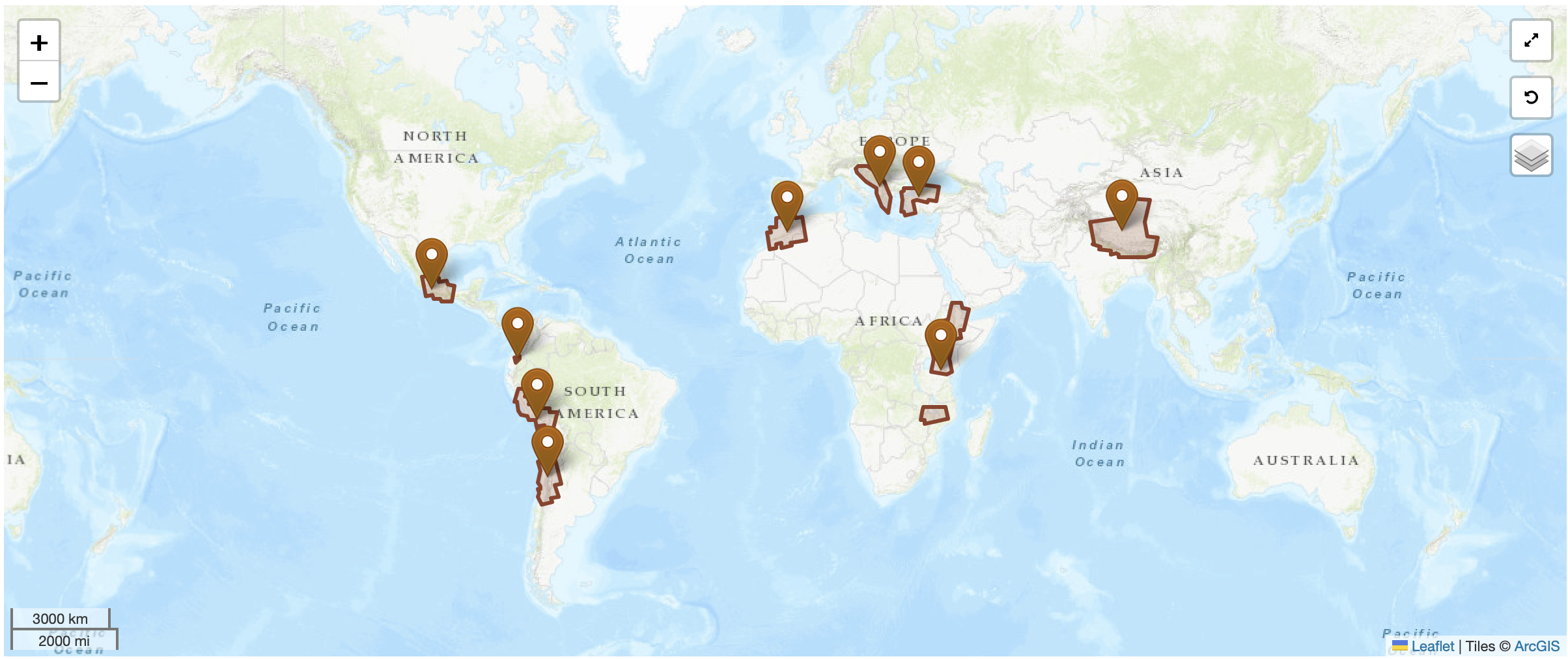
AI3 FLATSIM : 9 nouveaux projets lancés
Le 29 avril 2026, le kick-off du 3ème appel à idées FLATSIM a réuni porteurs de projets et équipes techniques pour lancer officiellement 9 nouveaux chantiers scientifiques. Les 9 projets […]
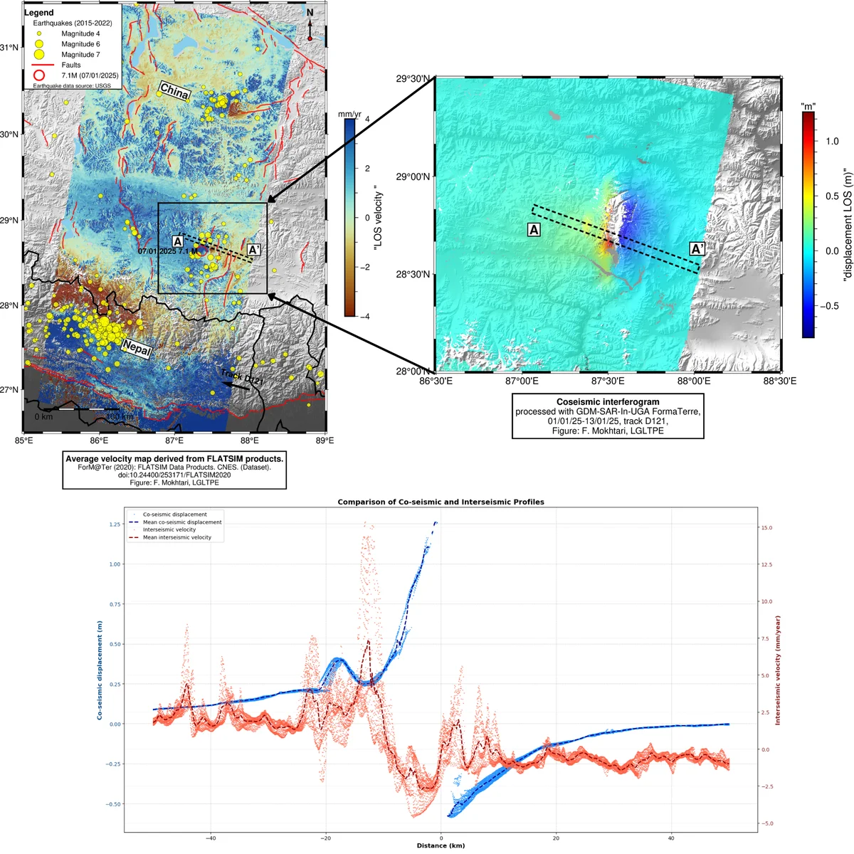
ÉTUDE DU SÉISME DU TIBET AVEC LES SERVICES FORMATERRE GDM-SAR-IN ET FLATSIM
Le 7 janvier 2025, un séisme de magnitude de moment 7,1 a frappé la partie méridionale du plateau tibétain, en Chine, près de la frontière népalaise. Cet événement a rompu […]
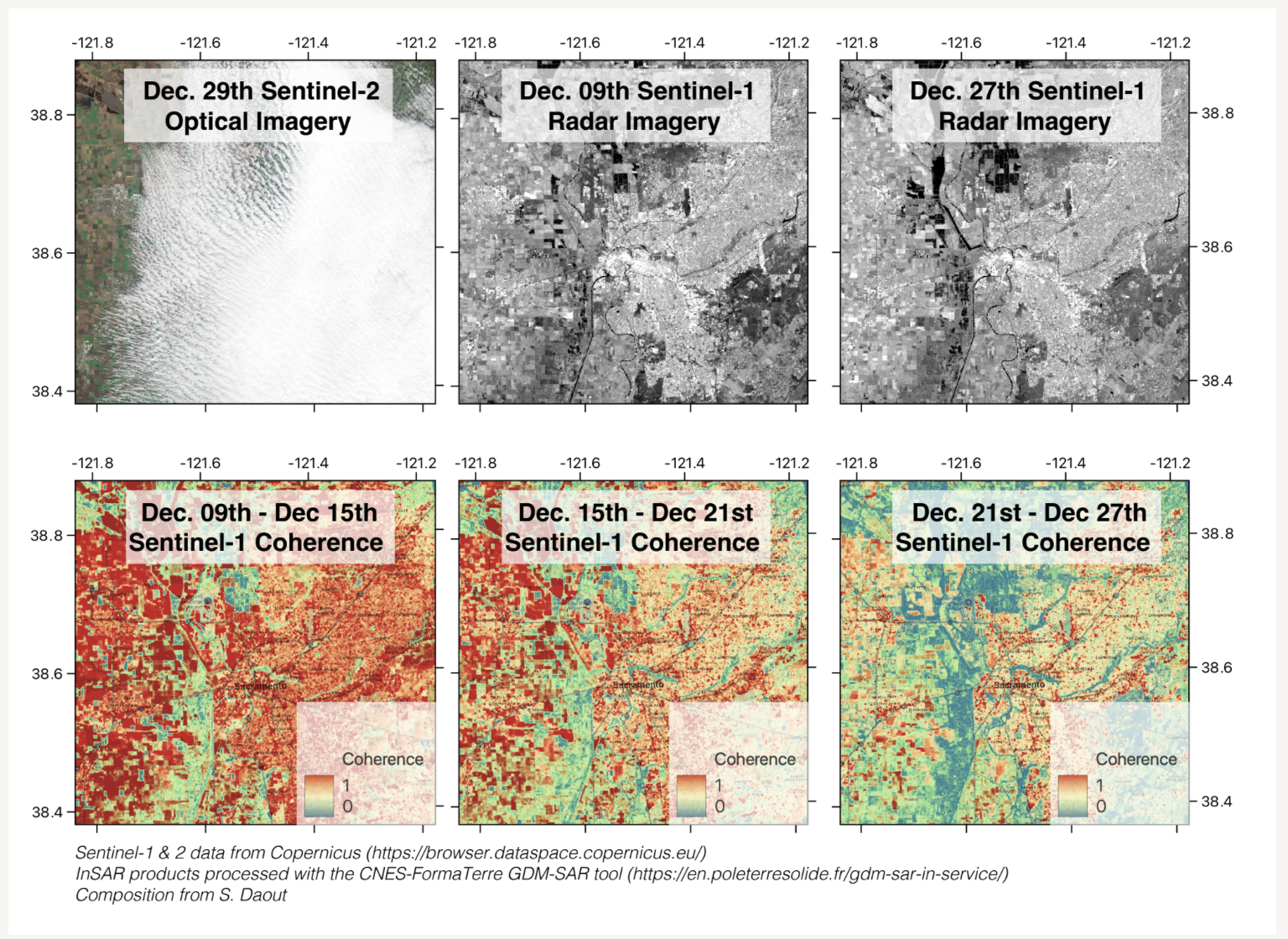
Suivi de l’inondation de Sacramento avec le service FormaTerre GDM-SAR-IN
L’imagerie optique est souvent limitée par la couverture nuageuse, contrairement à l’imagerie SAR (Synthetic Aperture Radar), qui permet d’acquérir des données satellites de jour comme de nuit et par tous […]
FLATSIM : une aventure scientifique qui s’accélère
Le service FLATSIM franchit une nouvelle étape avec son 3ème appel à idées et l’élargissement de ses thématiques. Retour sur une année riche en avancées et en perspectives. Janvier 2025 […]
g dfsg
TAB 4 CONTENT
dfs gdsfg dsf
gdfsg dfsg dfs
g dfsg
TAB 5 CONTENT
dfs gdsfg dsf
gdfsg dfsg dfs
g dfsg
TAB 6 CONTENT
dfs gdsfg dsf
gdfsg dfsg dfs
g dfsg