Le 9 avril 2021 à 15h UTC a eu lieu une nouvelle éruption au Piton de la Fournaise (http://www.ipgp.fr/fr/ovpf/actualites-ovpf). Le Service d’Observation OI2/ISDeform/INSU a imagé les déplacements du sol induits par l’éruption à partir de données Sentinel-1 band-C fournies par l’agence spatiale européenne.
April 2021 eruption at Piton de la Fournaise imaged by Sentinel-1
J.-L. Froger, OPGC, Alexis Hrysiewicz, UCD, April 2021
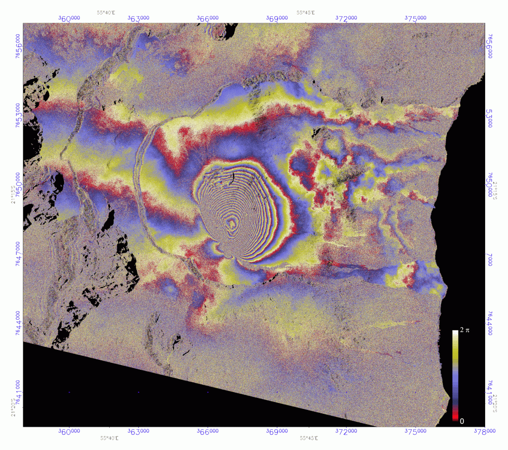
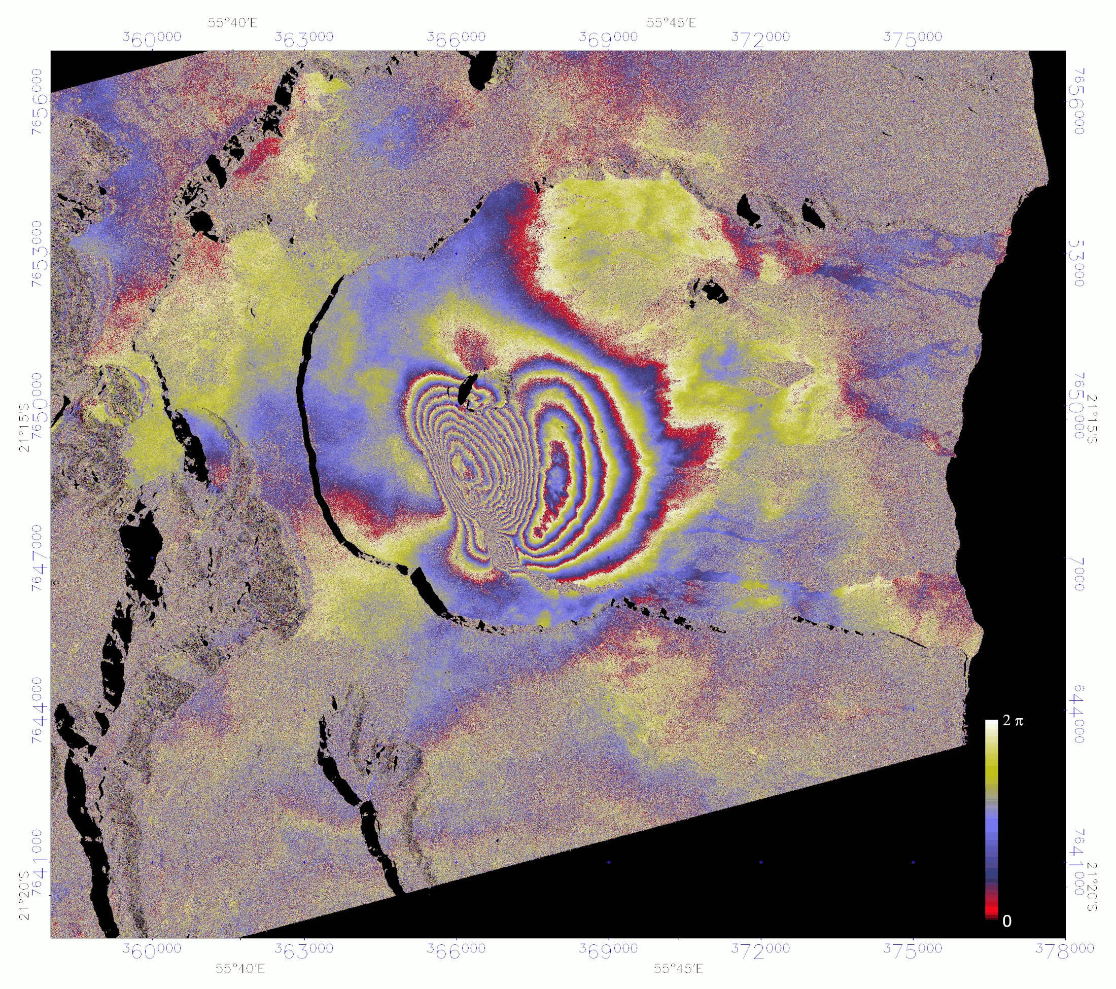
On April 9th 2021 at 15:00 UTC, a new eruption started at Piton de La Fournaise volcano, La Réunion Island, Indian Ocean (http://www.ipgp.fr/fr/ovpf/actualites-ovpf). The two main vents are located 700 m to the SW of Château Fort Crater at the southern base of the summit cone (Figs. 1 & 2). On morning of April 12, the lava flow has traveled ~3 km to the ESE of the vents. Using C-band Sentinel-1 data provided by European Space Agency (ESA), the OI2/ISDeform/INSU Observation Service has imaged the ground surface displacements induced by the eruption.
Figure 1. Descending Sentinel-1 Stripmap interferogram (S4, 26252_26427, 31/03/2021 – 12/04/2021) showing ground surface displacement related to the April 2021 eruption at Piton de la Fournaise, La Reunion Island. A complete cycle of phase (red-blue-yellow) represents an increase in range of ~ 2.8 cm between the ground surface and the satellite. Coordinates are in kilometers UTM (40 zone South). The interferogram shows a concentric pattern of fringes on the southeastern flank of the Piton de la Fournaise summit cone. The maximum displacement, located at the center of the pattern is about 56 cm to the satellite. The incoherent area, at the southeastern margin of the displacement pattern, corresponds to the lava flow emplaced during the April 2021 eruption. The satellite line-of-sight direction is from ESE to WNW.Figure 2. Ascending Sentinel-1 Stripmap interferogram (S6, 26245_26420, 30/03/2021 – 11/04/2021) showing ground surface displacement related to the April 2021 eruption at Piton de la Fournaise, La Reunion Island. A complete cycle of phase (red-blue-yellow) represents an increase in range of ~2.8 cm between the ground surface and the satellite. Coordinates are in kilometers UTM (40 zone South). The interferogram shows a superimposition of two concentric patterns of fringes on the southeastern flank of the Piton de la Fournaise summit cone. The maximum of the first pattern, located to the south of Dolomieu crater at the Central Cône summit corresponds to a ground surface displacement of about 25 cm to the satellite. The maximum of the second pattern, corresponds to a ground surface displacement of about 12 cm away from the satellite. The incoherent area, at the southeastern margin of the displacement pattern, corresponds to the lava flow emplaced during the April 2021 eruption. The satellite line-of-sight direction is from WSW to ENE.
The interferograms was produced by the OI2/ISDeform/INSU Observation Service, using the Diapason software (Altamira-Information). This work was supported by public funds from INSU.